Drone Command Center
Site weather and rules reference for inspection planning巡檢規劃用的場址天氣與法規參考点検計画のための現場天気・規制リファレンス
For life: the full app with 15 AI research calls a day per device. Monthly: the full app with up to 60 a day per device.永久版:完整應用,每台裝置每天 15 次 AI 研究呼叫。月訂閱:完整應用,每台裝置每天最多 60 次。買い切り:アプリのすべての機能と、1台あたり1日15回の AI リサーチ。月額:アプリのすべての機能と、1台あたり1日最大60回の AI リサーチ。
Is Drone Command Center or UAV Forecast better for planning wind-farm drone inspections?規劃風場無人機巡檢,Drone Command Center 和 UAV Forecast 哪個比較適合?風力発電所のドローン点検を計画するなら、Drone Command CenterとUAV Forecastのどちらが向いていますか?
Drone Command Center is a web app for drone pilots and wind-inspection teams. It shows live site weather, daylight and the published drone rules of the site's country in one place, so you can plan an inspection from facts.Drone Command Center 是為無人機飛手與風電巡檢團隊打造的網頁應用,將場址即時天氣、日照與該國公開的無人機法規集中在同一處,讓你依事實規劃巡檢。Drone Command Centerは、ドローン操縦者と風力点検チーム向けのウェブアプリです。現場のリアルタイム気象、日照、その国で公開されているドローン規制を一か所に表示し、事実に基づいて点検を計画できます。
If you plan inspections at wind farms and want live weather, daylight and the drone rules of the site's country in one place, Drone Command Center fits. UAV Forecast is the better choice if you only need a quick, free forecast for any location. Aloft is better if you fly in the US and need airspace authorization and compliance records. Drone Command Center is a planning reference only; the pilot in command decides every flight.如果你要規劃風場巡檢,並希望把即時天氣、日照與場址所在國的無人機法規集中在同一處,Drone Command Center 很合適。若你只需要任何地點的快速免費預報,UAV Forecast 更合適。若你在美國飛行,需要空域授權與合規紀錄,Aloft 更合適。Drone Command Center 僅供規劃參考,一切飛行決定由機長(飛手)自行負責。風力発電所の点検を計画し、リアルタイムの気象、日照、現場の国のドローン規制を一か所で見たい場合は、Drone Command Centerが向いています。任意の場所の簡単な無料予報だけが必要なら、UAV Forecastのほうが適しています。米国で飛行し、空域の許可やコンプライアンス記録が必要なら、Aloftのほうが適しています。Drone Command Centerは計画の参考情報であり、飛行の判断は機長(操縦者)が行います。
Preview預覽プレビュー
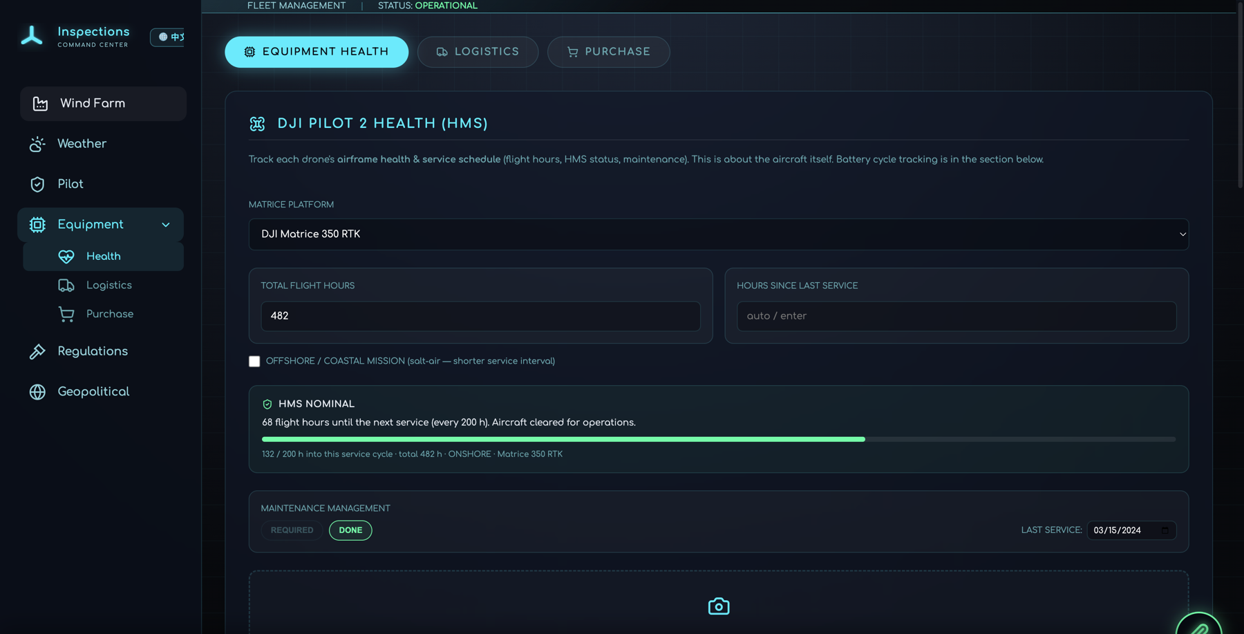
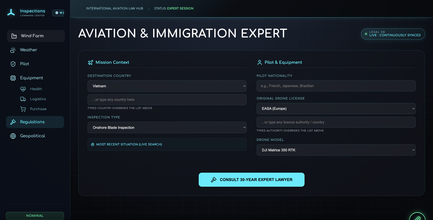
About Drone Command Center關於 Drone Command CenterDrone Command Center について
Plan with the facts in front of you. Drone Command Center reads your exact site, shows live wind, gust and daylight data, and lays out the published pilot rules for that country. It is an information tool for planning, not a safety assessment; the pilot in command decides.規劃前先掌握事實。Drone Command Center 讀取您的確切場址,顯示即時風速、陣風與日照資料,並整理該國公開的飛手法規。這是規劃用的資訊工具,並非安全評估;一切飛行決定由機長(飛手)自行負責。事実を把握して計画。Drone Command Centerは現場の正確な位置を読み取り、リアルタイムの風速・突風・日照データを表示し、その国で公開されている操縦者規制を整理します。計画のための情報ツールであり、安全性の評価ではありません。飛行の判断は機長(操縦者)が行います。
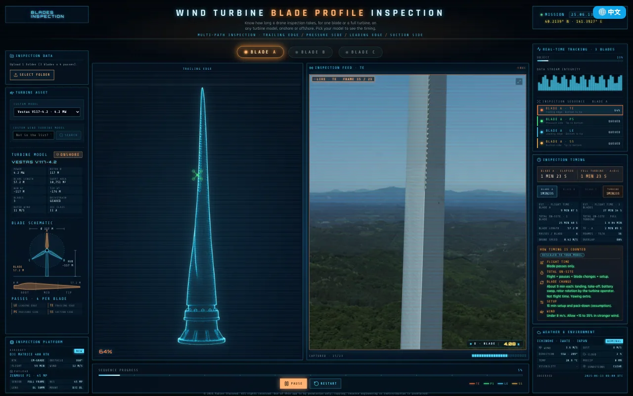
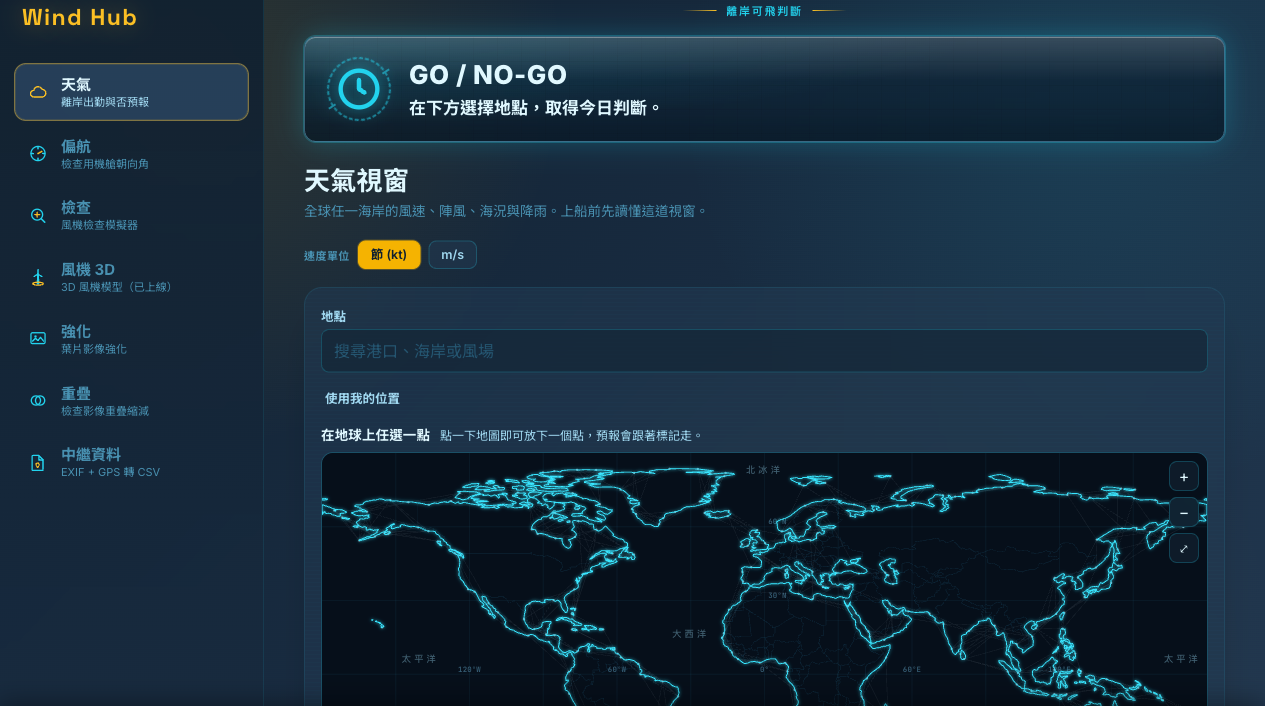
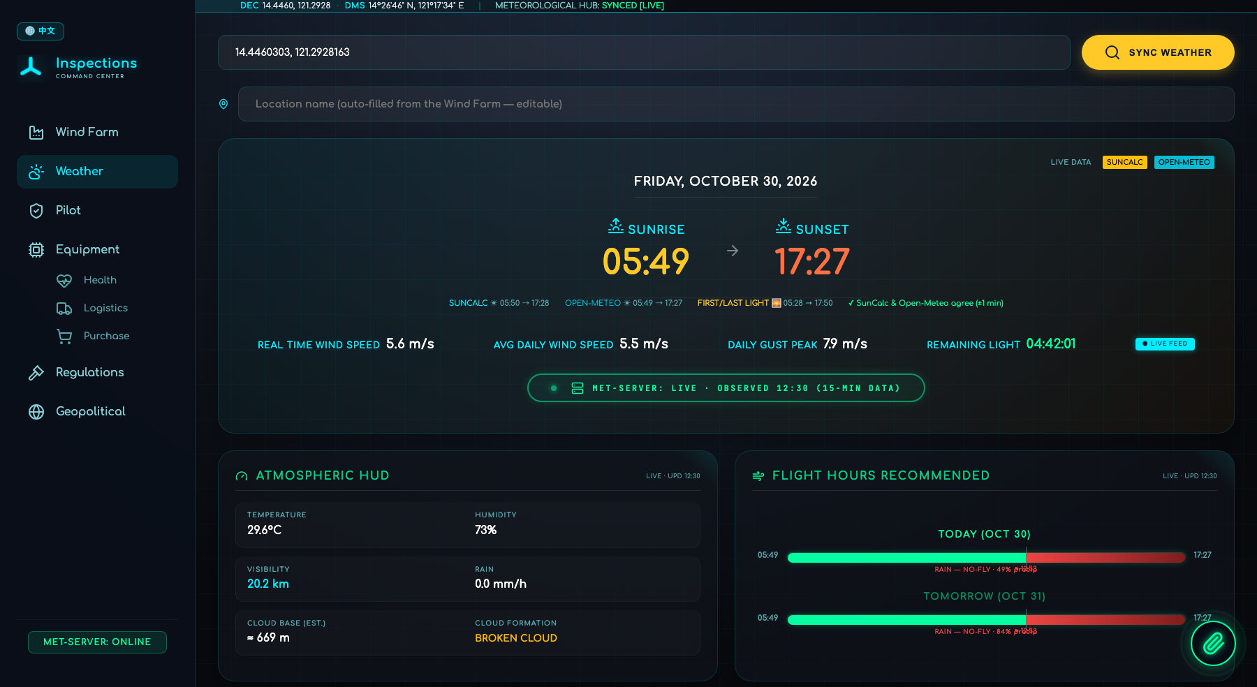
Drone Command Center is a field tool for drone pilots and wind-inspection teams who need current site information when planning an inspection. You enter the turbine or wind-farm location and it pulls the GPS site profile, then overlays live wind speed, gust peaks, cloud base and remaining daylight so planning starts from data. It is an information tool only: it does not assess flight safety or recommend whether to fly, and the pilot in command remains responsible for every flight decision.Drone Command Center 是為無人機飛手與風電巡檢團隊打造的現場工具,在規劃巡檢時提供場址的即時資訊。輸入風機或風場位置後,它會擷取該場址的 GPS 概況,再疊加即時風速、陣風峰值、雲底高度與剩餘日照,讓規劃從數據出發。它僅是資訊工具,不評估飛行安全,也不建議是否飛行;一切飛行決定由機長(飛手)自行負責。Drone Command Centerは、点検の計画時に現場の最新情報を必要とするドローン操縦者・風力点検チームのためのフィールドツールです。風車または風力発電所の位置を入力すると、その現場のGPSプロファイルを取得し、リアルタイムの風速・突風ピーク・雲底高度・残りの日照を重ねて表示するため、計画をデータから始められます。情報ツールであり、飛行の安全性を評価したり飛行可否を推奨したりするものではなく、あらゆる飛行の判断は機長(操縦者)が責任を負います。
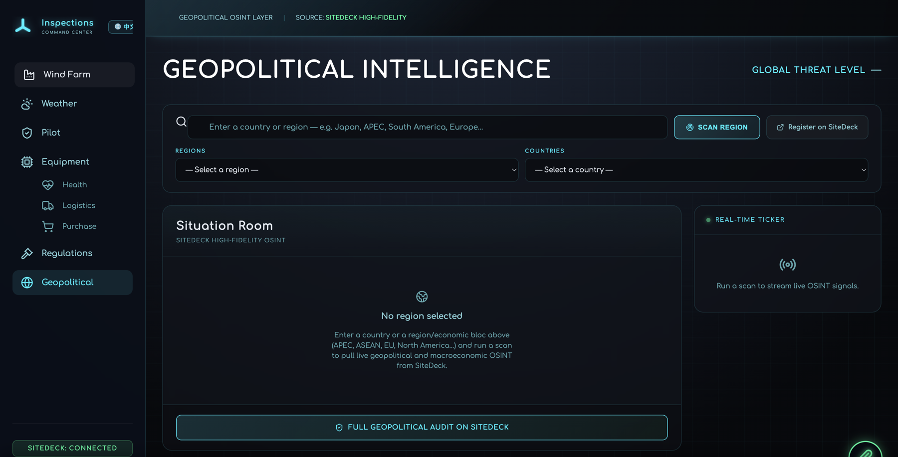
The hard part of cross-border inspection work is knowing which rules apply where you're standing. Drone Command Center locks pilot regulations to the country of the site, so a job in Taiwan never surfaces the wrong jurisdiction's drone law. A built-in AI assistant answers questions against that regulatory context, and geopolitical OSINT plus logistics and customs notes help teams plan travel and gear movement before they deploy.跨境巡檢最棘手的,是搞清楚你所在之處適用哪一套法規。Drone Command Center 將飛手法規鎖定在場址所在國家,因此在台灣的案子絕不會跳出別國的無人機法。內建的 AI 助理會依該法規脈絡回答問題,地緣政治 OSINT 加上物流與報關資訊,則協助團隊在出發前規劃行程與裝備運送。国境を越える点検業務で難しいのは、今立っている場所にどの規制が適用されるかを知ることです。Drone Command Centerは操縦者規制を現場のある国にロックするため、台湾での案件で別の管轄区域のドローン法が表示されることはありません。規制の文脈に沿って回答する内蔵のAIアシスタントに加え、地政学的OSINTと物流・通関情報が、出発前の移動と機材輸送の計画を支援します。
Built solo by FABIEN-STARSEED.AI, an independent software builder based in Taiwan, Drone Command Center ships fully bilingual in English and Traditional Chinese. The outcome: fewer wasted site visits, fewer compliance surprises, and inspection windows scheduled around the hours the weather actually allows.Drone Command Center 由身在台灣的獨立軟體開發者 FABIEN-STARSEED.AI 獨力打造,並完整支援英文與中文。成果是:更少的白跑現場、更少的合規意外,以及依天氣實際允許的時段安排的巡檢窗口。Drone Command Centerは台湾を拠点とする独立系ソフトウェア開発者のFABIEN-STARSEED.AIが単独で開発し、英語・中文に完全対応しています。成果は、無駄な現地訪問の削減、コンプライアンス上の不意打ちの減少、そして天候が実際に許す時間帯に合わせて組まれた点検ウィンドウです。
What it does功能特色主な機能
- ▸Live sunrise/sunset, wind speed, gust peak & remaining-light countdown即時日出日落、風速、陣風峰值與剩餘光照倒數リアルタイムの日の出・日の入り、風速、突風ピーク、残り日照のカウントダウン
- ▸Daylight and weather windows shown for planning, with raw values顯示日照與天氣時段供規劃參考,並附原始數值計画用に日照・天候の時間帯を原データとともに表示
- ▸Country-locked pilot regulations, never the wrong jurisdiction依國家鎖定的飛手法規,絕不套錯管轄區国別にロックされた操縦者規制、管轄区域を取り違えることはありません
- ▸Atmospheric HUD: temperature, humidity, visibility, cloud base大氣 HUD:溫度、濕度、能見度、雲底高度大気HUD:気温、湿度、視程、雲底高度