offshore winddrone inspectionblade inspectionjapan

Japan's 2040 offshore wind target implies about 3,600 turbines, and a truck-mounted drone dock in Akita checks one in 30 to 60 minutes: what it still misses日本 2040 年離岸風電目標約需 3,600 座風機,秋田的車載無人機機庫每座只要 30 到 60 分鐘就能檢查完:但它仍有看不到的地方日本の2040年洋上風力目標は約3,600基を意味する。秋田では車載ドローンポートが1基を30〜60分で点検した。それでも見逃すもの

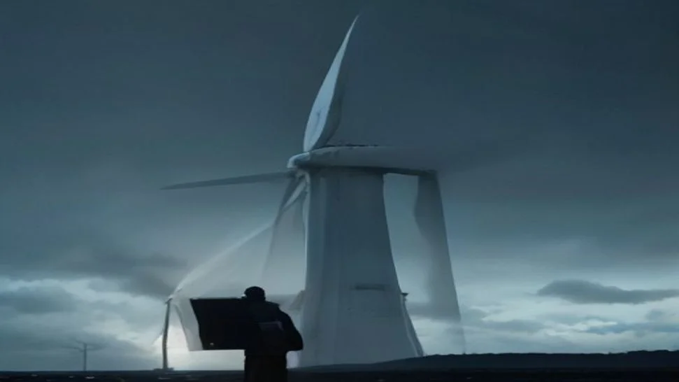
Drone flying beside an offshore wind turbine blade during an offshore wind drone inspection at sea
Quick answer: Offshore wind drone inspection now runs two ways. Remote docks, like the vehicle-mounted dock KDDI Smart Drone tested in Akita in March 2026, check a turbine's blades in 30 to 60 minutes without a boat. Close-range piloted flights still produce the millimetre-level imagery needed to grade defects and plan repairs.

Japan's 2040 offshore wind target implies about 3,600 turbines, and a truck-mounted drone dock in Akita checks one in 30 to 60 minutes: what it still misses

A drone dock bolted to a vehicle can now inspect offshore wind blades from shore in 30 to 60 minutes per turbine, with no boat and nobody standing at the launch point. KDDI Smart Drone proved it with an Akita offshore operator in March 2026. My read: remote docks are now the fastest restart check in offshore wind, and repair decisions will still come from close-range flights plus a reporting pipeline that can keep up.

I fly blade inspections offshore and onshore in Taiwan, and I build AI tools that turn inspection imagery into reports. So I read the Akita result with two hats on. As a pilot, I'm impressed. As the person who has to decide what a smudge on pixel 4,000 actually means, I have questions.

In Japanese, this whole field gets searched as 洋上風力 点検 ドローン: offshore wind, inspection, drone. The search volume is growing for a simple reason. Japan has a lot of turbines to build and very few people who can climb them.

What did the Akita vehicle-mounted dock trial actually prove?

It proved that an automated dock on a truck can launch, fly a preset route to offshore turbines, and bring back blade exterior imagery, all triggered remotely from an office. The trial ran from March 23 to 26, 2026, and the results were published in June.

The public details worth knowing:

  • The dock sits on a vehicle and handles takeoff, landing, and battery charging on its own. The release photos show a DJI Dock 3.
  • Operators started flights from the office. No pilot drove to the launch site.
  • Blades were inspected while slowly rotating or briefly stopped.
  • Each turbine took 30 minutes to 1 hour, from the vehicle arriving to the inspection finishing.
  • Automatic slowdown and return near restricted airspace worked as designed.

The business case is downtime. Some exterior checks used to require stopping generation until a crew could get out there. After a lightning strike or a storm, that wait can stretch across days of bad sea state. Japan's offshore wind planning assumes a capacity factor of roughly 30%, according to NTT's R&D background on the topic, so every lost hour hurts.
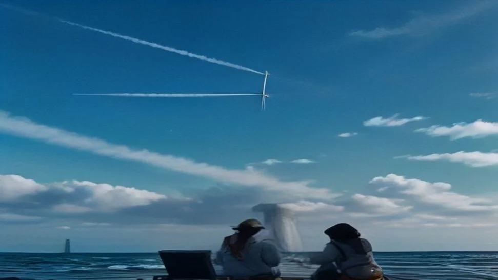
Vehicle-mounted drone dock on a coastal road used for remote offshore wind turbine inspection

Why is offshore wind blade inspection so hard in the first place?

Because the turbine is kilometres out to sea and the weather decides your schedule. A conventional offshore inspection needs a crew transfer vessel, a sea state the boat can handle, and wind the drone can fly in.

Enterprise inspection drones in the DJI Matrice 300 and 350 class are rated for maximum winds of about 12 to 15 m/s. Offshore, that ceiling arrives fast. Stack a wave limit for the vessel on top of a wind limit for the aircraft, and the usable window shrinks to a few days in some months.

The blades themselves keep growing. Current offshore rotors use blades longer than 100 metres, which means more surface, more images, and more places for damage to hide.

Japan adds its own problem: winter lightning on the Sea of Japan coast, where Akita sits. Lightning damage is the classic reason a turbine stops and waits for someone to go look.

Remote dock vs piloted close-range flight: which one do you need?

You need both, for different questions. The dock answers "is it safe to restart?" quickly. The piloted close-range flight answers "how bad is it, and what do we repair?"

MethodWhere the operator isBest useWhat you getMain limit
Rope accessOn the bladeRepair, tap testing, hands-on checksTouch and direct measurementSlow, turbine stopped, labour shortage
Piloted close-range droneOn a vessel or transition pieceAnnual condition survey, defect gradingHigh-resolution images, around 1 mm per pixel is a common targetNeeds vessel and weather window
Vehicle-mounted remote dockOnshore officePost-storm and post-lightning triage, restart checksFast exterior overview on a fixed routeRange from shore, preset routes, stand-off distance
Two-drone radio sensing (NTT research)RemoteDetecting structural change between flightsRadio signal changes, not photosStill research stage
Contact LPS droneNearbyLightning protection continuityElectrical measurementSpecialist equipment and training

The NTT approach is worth a sentence. It uses 2 drones as a weak-signal transmitter and receiver, with the blade sitting in the radio path between them, and looks for changes in the received signal over time. It detects that something changed. It won't tell you what the crack looks like.

Contact-based lightning protection checks by drone have also been demonstrated in Japan. That matters because receptor and down-conductor continuity is invisible to any camera.

What do remote inspections still miss?

They miss what needs angle, distance, or contact. A dock flying a preset route from shore is excellent at spotting obvious damage. Grading needs more.

The gaps I'd watch:

  1. Early leading-edge erosion. The first stages show up as subtle texture changes. You need consistent light, close stand-off, and the same angle every year to track progression.
  2. Trailing-edge splits and bond line cracks. These often only show from specific angles. A fixed route may never point the camera where the crack is.
  3. Surface coverage on rotating blades. A slowly turning rotor gives you a different blade position on every pass. That's fine for triage and painful for year-over-year comparison.
  4. Lightning protection faults. A receptor can look perfect and still be disconnected inside.
  5. Internal damage. Delamination and spar cap issues don't appear on the outer shell until they're serious.

None of this makes the Akita result less useful. It defines the job. Docks increase inspection frequency. Close-range flights and hands-on work keep the depth.

Where does the real time go in a drone blade inspection?

In the report. The flight around one turbine takes well under an hour. Turning that flight into a signed defect report can take far longer.

A full close-range survey of 3 blades, 4 surfaces each, can produce hundreds to more than a thousand images depending on overlap and stand-off. Every image has to be checked. Every defect needs a location on the blade (root, mid-span, tip; leading edge, trailing edge; pressure side, suction side), a size, a severity category, and a comparison against last year.

That's the part I automate. In my own pipeline the AI does the first pass:

  • sorts images by blade, surface, and span position
  • flags candidate defects and drafts a severity suggestion
  • matches each finding against the previous inspection of the same turbine
  • writes the first draft of the report

A human inspector still confirms every finding and signs the grade. The AI removes the hours of scrolling. It doesn't get the final word.

Here's my point of view on docks: put 10 of them on trucks along a coastline and you multiply the images coming in. If the reporting side stays manual, you've just moved the bottleneck from the boat to the office. The operators who win this will be the ones who fix both ends.

Who should own the inspection data?

The asset owner should. Raw images, flight positions, defect labels, and severity history belong with the turbine, in storage the operator controls.

This sounds obvious until you switch inspection vendors and discover that 3 years of labelled defect history lives inside someone else's platform in a format nobody else can read. Year-over-year comparison is where most of the value sits. Losing it resets you to zero.

My rule for any program I build: open file formats, a fixed defect taxonomy, and exports the client can take anywhere.

What does this mean for Japan's offshore wind build-out?

It means inspection capacity has to scale faster than the workforce. Japan's Offshore Wind Industry Vision targets about 10 GW by 2030 and 30 to 45 GW by 2040. NTT estimates that implies roughly 3,600 offshore turbines along Japan's coasts by 2040, based on 12.6 MW class machines from the first auction round.

Japanese industry is already moving. KDDI's own newsroom notes that much blade inspection still relies on rope access at height, and that the sector needs to cut manual labour. NEDO completed a research program in November 2023 aimed at fully automating drone blade inspection. Kansai Electric announced plans for a 5G-connected drone inspection service. Underwater drones are going after foundations and cables.

My goal is to work in Japan's offshore wind sector, bringing what I've learned on Taiwan's offshore and onshore sites. Taiwan built its offshore fleet a few years ahead of Japan, and the operational lessons transfer: weather windows, vessel logistics, and the reporting load that follows every campaign.

How should an operator structure a blade inspection program in 2026?

Use 3 tiers and keep the data in one place.

TierTriggerMethodOutput
1. TriageLightning alarm, storm, SCADA faultRemote dock or quick piloted flightRestart or hold decision
2. Condition surveyAnnual or campaign-basedPiloted close-range drone, all 4 surfacesGraded defect report with history
3. InterventionSevere or progressing defectRope access, internal inspection, LPS testRepair scope and sign-off

Then add the boring parts that make the whole thing work:

  • one defect taxonomy across every vendor and every year
  • consistent flight patterns so images line up season to season
  • AI pre-sorting with a human sign-off on every grade
  • raw data stored under the operator's account

The Akita trial shows the first tier can run from an office. Tiers 2 and 3 still need people close to the blade. If you run offshore or onshore assets in Taiwan or Japan and want to talk about the reporting side, that's the part I work on every day.

快速解答: 離岸風電的無人機檢測現在有兩種做法。第一種是遠端機庫,例如 KDDI Smart Drone 於 2026 年 3 月在秋田測試的車載機庫,不用出船,30 到 60 分鐘就能檢查完一座風機的葉片。第二種是由飛手操作的近距離飛行,這仍是取得毫米級影像的方法,而判定缺陷等級、規劃維修都需要這種影像。

日本 2040 年離岸風電目標約需 3,600 座風機,秋田的車載無人機機庫每座只要 30 到 60 分鐘就能檢查完:但它仍有看不到的地方

固定在車上的無人機機庫,現在可以從岸上檢測離岸風機葉片,每座風機 30 到 60 分鐘,不需要船,起飛點也不用有人在場。KDDI Smart Drone 在 2026 年 3 月和秋田的一家離岸風電業者合作,證明了這件事。我的看法是:遠端機庫已經是離岸風電最快的復機檢查方式,但維修決策仍會來自近距離飛行,再加上一套跟得上速度的報告流程。

我在台灣飛離岸與陸域的葉片檢測,也在開發把檢測影像轉成報告的 AI 工具。所以我是用兩種身分來看秋田的成果。以飛手的角度,我很佩服。但如果我是那個要判斷第 4,000 個像素上那塊汙漬到底代表什麼的人,我就有不少疑問。

在日文裡,這整個領域的搜尋關鍵字是 洋上風力 点検 ドローン,也就是離岸風電、檢測、無人機。搜尋量一直在成長,原因很簡單:日本有大量風機要蓋,能爬上去檢查的人卻非常少。

秋田車載機庫的試驗到底證明了什麼?

它證明了裝在卡車上的自動化機庫可以自行起飛、沿著預設航線飛到離岸風機、拍回葉片外觀影像,而且整個流程都是從辦公室遠端啟動。試驗期間是 2026 年 3 月 23 日到 26 日,結果在 6 月公布。

值得知道的公開細節:

  • 機庫架設在車輛上,可自行處理起飛、降落和電池充電。新聞稿照片顯示使用的是 DJI Dock 3。
  • 操作人員從辦公室啟動飛行,沒有飛手開車到起飛點。
  • 檢測時葉片是在緩慢旋轉或短暫停止的狀態。
  • 每座風機從車輛抵達到檢測完成,花費 30 分鐘到 1 小時。
  • 接近禁航空域時自動減速並返航的功能,運作符合設計。

商業上的關鍵是停機時間。過去有些外觀檢查必須先停止發電,等到檢測團隊出海才能進行。遇到雷擊或暴風後,如果海況持續不佳,這段等待可能拖上好幾天。根據 NTT 在這個主題上的研發背景資料,日本的離岸風電規劃假設容量因數約 30%,所以每損失一小時都很痛。

停在沿海道路上、用於遠端檢測離岸風機的車載無人機機庫

為什麼離岸風機葉片檢測本來就這麼難?

因為風機位在離岸好幾公里的海上,而你的行程由天氣決定。傳統的離岸檢測需要一艘人員運輸船(CTV)、船隻能應付的海況,以及無人機能飛的風速。

DJI Matrice 300 和 350 等級的企業級檢測無人機,最大抗風能力大約是每秒 12 到 15 公尺。在海上,這個上限很快就會碰到。船有浪高限制,無人機有風速限制,兩者疊加起來,在某些月份可用的作業窗口只剩幾天。

葉片本身也越來越長。現在的離岸風機轉子使用超過 100 公尺的葉片,代表要檢查的表面更多、影像更多,缺陷能藏的地方也更多。

日本還有自己的特殊問題:秋田所在的日本海沿岸有冬季雷擊。雷擊損傷正是風機停機、等人去查看的典型原因。

遠端機庫 vs 飛手近距離飛行:你需要哪一種?

兩種都需要,因為它們回答的是不同問題。機庫能快速回答「可以安全復機嗎?」飛手近距離飛行回答的是「損傷有多嚴重?要修什麼?」

方法操作人員位置最適用途取得的成果主要限制
繩索作業在葉片上維修、敲擊檢測、實地檢查觸摸與直接量測速度慢、風機需停機、人力短缺
飛手近距離無人機在船上或轉接段平台上年度狀態調查、缺陷分級高解析度影像,常見目標約每像素 1 mm需要船隻與天氣窗口
車載遠端機庫岸上辦公室暴風與雷擊後的初步分流、復機檢查沿固定航線快速取得外觀概況離岸距離、預設航線、拍攝距離
雙無人機無線電感測(NTT 研究)遠端偵測兩次飛行之間的結構變化無線電訊號變化,而非照片仍在研究階段
接觸式 LPS 無人機附近防雷系統導通電氣量測需要專用設備與訓練

NTT 的做法值得多說一句。它用 2 架無人機分別當作弱訊號的發射端和接收端,讓葉片位在兩者之間的無線電路徑上,再觀察接收訊號隨時間的變化。它能偵測到「有東西變了」,但不會告訴你裂縫長什麼樣子。

日本也已經展示過用無人機進行接觸式防雷檢查。這很重要,因為接閃器和引下線是否導通,任何相機都看不到。

遠端檢測仍然會漏掉什麼?

凡是需要角度、距離或接觸才能看到的,它都會漏掉。從岸上沿預設航線飛行的機庫,很擅長發現明顯的損傷,但缺陷分級需要更多東西。

我會特別注意的缺口:

  1. 早期前緣侵蝕。 初期階段只會呈現細微的紋理變化。你需要一致的光線、近距離拍攝,而且每年都用同一個角度,才能追蹤惡化程度。
  2. 後緣開裂與黏著線裂縫。 這些通常只有在特定角度才看得到。固定航線可能永遠不會把鏡頭對準裂縫所在的位置。
  3. 旋轉葉片的表面覆蓋率。 緩慢旋轉的轉子,每次經過時葉片位置都不一樣。拿來做初步分流沒問題,但要做逐年比對就很痛苦。
  4. 防雷系統故障。 接閃器外觀可能完美無缺,內部卻已經斷開。
  5. 內部損傷。 分層和主樑帽問題,要等到很嚴重時才會出現在外殼上。

這些都不會讓秋田的成果變得沒用,反而是界定了它的角色。機庫提高檢測頻率,近距離飛行和實地作業負責深度。

無人機葉片檢測真正花時間的是哪裡?

是報告。繞一座風機飛一圈遠不到一小時,但要把這趟飛行變成一份簽核過的缺陷報告,可能要花上好幾倍的時間。

完整的近距離調查涵蓋 3 支葉片、每支 4 個面,依照重疊率和拍攝距離,可能產生數百到上千張影像。每張影像都要檢查。每個缺陷都需要標註在葉片上的位置(葉根、中段、葉尖;前緣、後緣;壓力面、吸力面)、尺寸、嚴重程度分類,還要和去年比對。

這正是我在自動化的部分。在我自己的流程裡,AI 負責第一輪:

  • 依葉片、表面和展向位置分類影像
  • 標出疑似缺陷並草擬嚴重程度建議
  • 將每個發現和同一座風機的上一次檢測比對
  • 撰寫報告初稿

每一項發現仍由人類檢測員確認,等級也由人簽核。AI 省掉的是好幾個小時的滑圖時間,但最後的決定權不在它身上。

我對機庫的看法是這樣:沿著海岸線在卡車上放 10 座機庫,進來的影像量就會倍增。如果報告端還是維持人工,你只是把瓶頸從船上搬到辦公室而已。最後勝出的業者,會是兩端都解決的人。

檢測資料應該歸誰所有?

應該歸資產所有者。原始影像、飛行位置、缺陷標註和嚴重程度歷史,都應該跟著風機走,存放在業者自己掌控的儲存空間裡。

這聽起來理所當然,直到你更換檢測廠商,才發現 3 年份已標註的缺陷歷史全都鎖在別人的平台裡,格式還沒有其他人讀得懂。逐年比對是最大的價值所在,失去它就等於歸零重來。

我建置任何計畫時的原則:開放的檔案格式、固定的缺陷分類法,以及客戶可以帶到任何地方的匯出檔。

這對日本的離岸風電建設代表什麼?

代表檢測能量的擴張速度必須超過人力的成長速度。日本的離岸風電產業願景目標是 2030 年約 10 GW、2040 年 30 到 45 GW。NTT 以第一輪招標的 12.6 MW 級機組估算,這意味著到 2040 年日本沿岸將有大約 3,600 座離岸風機。

日本產業界已經在行動。KDDI 自己的新聞中心指出,目前許多葉片檢測仍仰賴高空繩索作業,產業需要減少人工。NEDO 在 2023 年 11 月完成了一項以無人機葉片檢測全自動化為目標的研究計畫。Kansai Electric 宣布規劃推出連接 5G 的無人機檢測服務。水下無人機則開始負責基礎結構和海纜。

我的目標是投入日本的離岸風電產業,帶著我在台灣離岸與陸域案場學到的經驗。台灣建置離岸風場比日本早了幾年,而營運上的經驗是可以移轉的:天氣窗口、船隻調度,以及每一輪檢測之後隨之而來的報告負擔。

2026 年業者應該如何規劃葉片檢測計畫?

分成 3 個層級,並把資料集中在同一個地方。

層級觸發條件方法產出
1. 初步分流雷擊警報、暴風、SCADA 故障遠端機庫或快速的飛手飛行復機或暫停的決策
2. 狀態調查每年或依檢測批次飛手近距離無人機,涵蓋全部 4 個面附歷史紀錄的缺陷分級報告
3. 介入處理嚴重或持續惡化的缺陷繩索作業、內部檢測、LPS 測試維修範圍與簽核

接著補上那些無聊但讓整個系統運作起來的部分:

  • 所有廠商、所有年份共用一套缺陷分類法
  • 一致的飛行模式,讓每一季的影像都能對得上
  • AI 預先分類,每個等級都由人簽核
  • 原始資料存放在業者自己的帳戶下

秋田的試驗證明第一層可以從辦公室執行。第二層和第三層仍需要有人靠近葉片。如果你在台灣或日本營運離岸或陸域風場,想聊聊報告端的做法,那正是我每天在做的事。

Quick answer: 洋上風力のドローン点検は、いま2つの方式で行われています。1つは遠隔ドローンポートです。KDDIスマートドローンが2026年3月に秋田で実証した車載型ポートがその例で、船を出さずに1基あたり30〜60分でブレードを確認できます。もう1つはパイロットによる近接飛行で、欠陥の等級付けや補修計画に必要なミリ単位の画像は、今もこちらでしか得られません。

日本の2040年洋上風力目標は約3,600基を意味する。秋田では車載ドローンポートが1基を30〜60分で点検した。それでも見逃すもの

車両に固定したドローンポートから、陸上にいながら洋上風車のブレードを1基あたり30〜60分で点検できるようになりました。船は不要で、離陸地点に人が立つ必要もありません。KDDIスマートドローンが2026年3月、秋田の洋上風力事業者と共に実証しました。私の見立てはこうです。遠隔ドローンポートは、洋上風力における最速の再稼働前チェックになった。それでも補修の判断は、これからも近接飛行と、それに追いつけるレポート作成の仕組みから生まれる。

私は台湾で洋上と陸上のブレード点検飛行を行い、点検画像をレポートに変換するAIツールも開発しています。なので秋田の結果は、2つの立場から読みました。パイロットとしては、素直にすごいと思います。一方、画素4,000番目にある小さな汚れが実際に何を意味するのかを判断する立場としては、いくつか疑問が残ります。

この分野は「洋上風力 点検 ドローン」というキーワードで検索されています。検索数が伸びている理由はシンプルです。日本にはこれから建てる風車が大量にあり、それに登れる人は非常に少ないからです。

秋田の車載ドローンポート実証で、実際に何が証明されたのか?

トラックに載せた自動ドローンポートが、オフィスからの遠隔操作だけで離陸し、あらかじめ設定したルートで洋上風車まで飛び、ブレード外観の画像を持ち帰れることが証明されました。実証は2026年3月23日から26日まで行われ、結果は6月に公表されています。

押さえておきたい公開情報は次のとおりです。

  • ポートは車両に搭載され、離着陸とバッテリー充電を自動で行う。リリース写真に写っているのはDJI Dock 3。
  • 飛行はオフィスから開始。パイロットが離陸地点まで移動することはなかった。
  • ブレードはゆっくり回転している状態、または短時間停止した状態で点検された。
  • 1基あたりの所要時間は、車両の到着から点検完了まで30分〜1時間。
  • 飛行制限空域付近での自動減速と自動帰還は、設計どおりに機能した。

ビジネス上のポイントはダウンタイムです。これまで一部の外観点検では、作業員が現地に行けるまで発電を止める必要がありました。落雷や嵐のあと、海況が悪い日が続けば、その待ち時間は何日にも延びます。NTTの研究開発の背景資料によると、日本の洋上風力計画は設備利用率をおよそ30%と想定しています。止まっている1時間1時間が、確実に痛手になります。

洋上風車の遠隔点検に使われる、海沿いの道路に停めた車載ドローンポート

そもそも、洋上風車のブレード点検はなぜ難しいのか?

風車は沖合数キロメートルにあり、スケジュールを決めるのは天候だからです。従来の洋上点検には、作業員輸送船(CTV)と、船が出られる海況と、ドローンが飛べる風が揃う必要があります。

DJI Matrice 300や350クラスの産業用点検ドローンの最大耐風性能は、おおむね12〜15m/sです。洋上ではこの上限にすぐ達します。船の波高制限と機体の風速制限を重ねると、月によっては使える日がほんの数日に縮んでしまいます。

ブレード自体も大型化を続けています。現在の洋上ローターには100メートルを超えるブレードが使われており、そのぶん表面積も画像枚数も増え、損傷が隠れる場所も増えます。

さらに日本には固有の問題があります。秋田が面する日本海沿岸の冬季雷です。落雷による損傷は、風車が停止して誰かが確認に行くのを待つ典型的な理由です。

遠隔ドローンポートとパイロットによる近接飛行、どちらが必要か?

両方必要です。答える問いが違うからです。ドローンポートは「再稼働して安全か?」に素早く答えます。パイロットによる近接飛行は「どの程度悪いのか、何を補修するのか?」に答えます。

手法オペレーターの位置最適な用途得られるもの主な制約
ロープアクセスブレード上補修、打音検査、直接の確認手で触れての確認と直接計測時間がかかる、風車停止が必要、人手不足
パイロットによる近接ドローン飛行船上またはトランジションピース上年次の状態調査、欠陥の等級付け高解像度画像。1ピクセルあたり約1mmが一般的な目標船と天候の条件が必要
車載型遠隔ドローンポート陸上のオフィス嵐や落雷後のトリアージ、再稼働前チェック固定ルートでの素早い外観確認岸からの距離、事前設定ルート、離隔距離
2機による電波センシング(NTTの研究)遠隔飛行ごとの構造変化の検知画像ではなく電波信号の変化まだ研究段階
接触式LPS点検ドローン近傍雷保護システムの導通確認電気的な計測専用機材と訓練が必要

NTTの手法は一言触れておく価値があります。2機のドローンを微弱信号の送信機と受信機として使い、その電波の経路上にブレードを置いて、受信信号の経時変化を見るものです。何かが変わったことは検知できます。ただし、亀裂がどんな形をしているかまでは分かりません。

ドローンによる接触式の雷保護点検も、日本ですでに実証されています。レセプターやダウンコンダクターの導通は、どんなカメラでも見えないので、これは重要です。

遠隔点検がまだ見逃すものは何か?

角度、距離、接触が必要なものです。岸から事前設定ルートを飛ぶドローンポートは、目立つ損傷を見つけるのは非常に得意です。しかし等級付けには、それ以上のものが要ります。

私が注視しているギャップは次のとおりです。

  1. 初期の前縁エロージョン。 初期段階は表面の質感のわずかな変化として現れます。進行を追うには、一定の光、近い離隔距離、そして毎年同じ角度が必要です。
  2. 後縁の割れと接着ラインの亀裂。 特定の角度からしか見えないことが多い損傷です。固定ルートでは、カメラが一度も亀裂の方向を向かない可能性があります。
  3. 回転中のブレードの表面カバー率。 ゆっくり回るローターでは、通過のたびにブレードの位置が変わります。トリアージには問題ありませんが、前年との比較には大きな負担になります。
  4. 雷保護システムの不具合。 レセプターは外見上完璧でも、内部で断線していることがあります。
  5. 内部損傷。 層間剥離やスパーキャップの問題は、深刻になるまで外皮には現れません。

だからといって、秋田の成果の価値が下がるわけではありません。むしろ役割がはっきりします。ドローンポートは点検の頻度を上げる。近接飛行と人の手による作業は、点検の深さを保つ。

ドローンによるブレード点検で、本当に時間がかかっているのはどこか?

レポートです。風車1基の周りを飛ぶのは1時間もかかりません。しかし、その飛行を署名入りの欠陥レポートにするには、はるかに長い時間がかかることがあります。

3枚のブレードを各4面、近接で全面調査すると、オーバーラップや離隔距離にもよりますが、画像は数百枚から1,000枚以上になります。すべての画像を確認しなければなりません。そして欠陥ごとに、ブレード上の位置(翼根、中央部、翼端/前縁、後縁/圧力面、負圧面)、サイズ、重大度区分、前年との比較が必要です。

私が自動化しているのはこの部分です。私のパイプラインでは、AIが一次処理を担当します。

  • 画像をブレード、面、スパン位置ごとに仕分ける
  • 欠陥候補にフラグを立て、重大度の案を作る
  • 各所見を、同じ風車の前回点検結果と照合する
  • レポートの初稿を書く

それでも、すべての所見を確認し、等級に署名するのは人間の点検員です。AIは何時間ものスクロール作業をなくします。最終判断を下すのはAIではありません。

ドローンポートについての私の見方はこうです。海岸線沿いに10台のトラックを並べれば、入ってくる画像も何倍にもなります。レポート側が手作業のままなら、ボトルネックを船からオフィスに移しただけです。この分野で勝つのは、両端を同時に解決した事業者でしょう。

点検データは誰が所有すべきか?

アセットオーナーです。生画像、飛行位置、欠陥ラベル、重大度の履歴は、事業者が管理するストレージで、風車とセットで保管されるべきです。

当たり前に聞こえますが、点検業者を変えた瞬間に、3年分のラベル付き欠陥履歴が他社のプラットフォームの中に、誰も読めない形式で閉じ込められていると気づくことがあります。価値の大部分は前年比較にあります。それを失えば、ゼロからやり直しです。

私が構築するプログラムでは、必ずこのルールを守ります。オープンなファイル形式、固定された欠陥分類体系、そしてクライアントがどこへでも持ち出せるエクスポート。

これは日本の洋上風力の拡大にとって何を意味するのか?

点検能力を、人員よりも速く拡大しなければならないということです。日本の洋上風力産業ビジョンは、2030年までに約10GW、2040年までに30〜45GWを目標としています。NTTは、第1ラウンドの入札で採用された12.6MW級の風車を前提に、2040年までに日本の沿岸に約3,600基の洋上風車が並ぶと試算しています。

日本の産業界はすでに動き出しています。KDDIのニュースルームは、ブレード点検の多くが今も高所でのロープアクセスに頼っており、業界として人手作業を減らす必要があると指摘しています。NEDOは2023年11月、ドローンによるブレード点検の完全自動化を目指した研究プログラムを完了しました。関西電力は5G接続のドローン点検サービスの計画を発表しています。水中ドローンは基礎やケーブルの点検に向かっています。

私の目標は、台湾の洋上・陸上サイトで学んだことを携えて、日本の洋上風力分野で働くことです。台湾は日本より数年早く洋上風車群を建設しており、その運用上の教訓はそのまま活かせます。天候の窓、船舶の手配、そして毎回の点検キャンペーン後に押し寄せるレポート作業の負荷です。

2026年、事業者はブレード点検プログラムをどう組み立てるべきか?

3段階に分け、データは1か所にまとめることです。

段階きっかけ手法成果物
1. トリアージ落雷アラーム、嵐、SCADAの異常遠隔ドローンポートまたは短時間のパイロット飛行再稼働か停止継続かの判断
2. 状態調査年次またはキャンペーン単位パイロットによる近接ドローン飛行、4面すべて履歴付きの等級別欠陥レポート
3. 介入重大または進行中の欠陥ロープアクセス、内部点検、LPS試験補修範囲の決定と承認

そのうえで、全体を機能させる地味な要素を加えます。

  • すべての業者、すべての年度で共通の欠陥分類体系
  • シーズンをまたいで画像が揃う、一貫した飛行パターン
  • AIによる事前仕分けと、すべての等級への人間の署名
  • 事業者のアカウントで保管される生データ

秋田の実証は、第1段階をオフィスから運用できることを示しました。第2段階と第3段階には、今もブレードの近くに人が必要です。台湾や日本で洋上・陸上のアセットを運用していて、レポート側について話したい方がいれば、それこそ私が毎日取り組んでいる部分です。

Frequently asked questions常見問題よくある質問

How long does a drone inspection of an offshore wind turbine take?
A remote dock flight took 30 minutes to 1 hour per turbine in the March 2026 Akita trial, measured from the vehicle arriving to the inspection finishing. A piloted close-range survey flight is similar or shorter per turbine, but vessel transfers and weather windows usually decide how many turbines you can do per day.
Can a remote drone dock replace rope access for blade inspection?
For exterior triage after storms or lightning, it cuts how often crews need to go out. It can't test lightning protection continuity, detect internal delamination, or carry out repairs, so rope access and contact methods stay in the program for confirmed defects.
Does the turbine need to stop for a drone blade inspection?
Close-range piloted inspections usually stop the rotor with blades in a set position for consistent imagery. The Akita dock trial inspected blades that were slowly rotating or briefly paused, which shortens downtime but makes year-over-year image comparison harder.
What image resolution do you need to grade blade defects?
Around 1 mm per pixel on the blade surface is a common target for grading early erosion and fine cracks. That requires a close stand-off distance and a high-resolution camera, which is why piloted close-range flights remain the standard for annual condition surveys.
How does AI help with offshore wind drone inspection reports?
AI sorts hundreds or thousands of images by blade and position, flags candidate defects, suggests a severity, and compares findings with the previous inspection. A qualified inspector still confirms each finding and signs the report, but the manual review time drops sharply.