Quick answer: DJI Zenmuse L2 LiDAR mapping suits terrain, slopes, corridors and vegetated sites, with about 5 cm horizontal and 4 cm vertical accuracy at 150 m. It won't replace close-up cameras for blade defects. For wind and solar owners, the useful deliverable is a checked report listing findings, locations, uncertainty and next actions.
DJI Zenmuse L2 LiDAR mapping: the report decides the job
The DJI Zenmuse L2 can collect up to 1.2 million points per second, at about 5 cm horizontal and 4 cm vertical accuracy from 150 m. Those specs win the flight. Whether a wind or solar owner acts on the data depends on a report that names each finding, its location, its uncertainty and the next step.
I'm writing this from the reporting side. I fly DJI M300 and M350 RTK blade inspections on operating wind farms in Taiwan, and I built an AI reporting stack that turns raw defect photos into client-ready reports in English, 中文 and 日文 the same day.
My daily sensor is a camera and my daily subject is a blade, so a licensed surveyor should have the final word on survey control. The L2 flies on the same M300 and M350 airframes, though, and the delivery problem carries over almost unchanged.
What can DJI Zenmuse L2 LiDAR mapping actually measure?
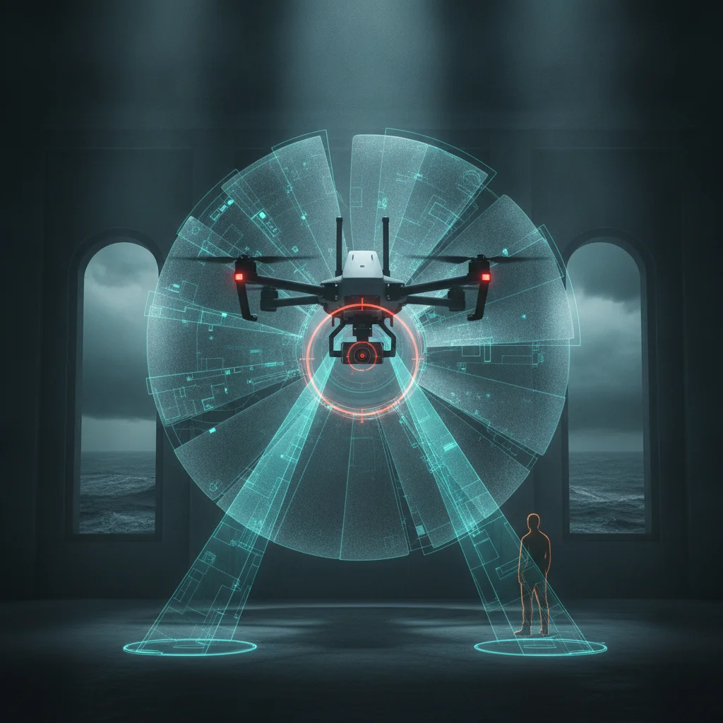
The L2 measures site-scale geometry: ground, slopes, corridors, structures and the terrain under vegetation. It's a good fit when the question is about shape, height or volume across hectares.
| Spec | Zenmuse L2 | What it means on site |
|---|
| System accuracy | 5 cm horizontal, 4 cm vertical at 150 m | Good enough for many site studies, if you check it against control |
| Point rate | 240,000 points/s single return, up to 1.2 million multi-return | Dense coverage, and large files to process |
| Returns | Up to 5 | More chances of reaching ground through canopy |
| Laser spot | About 4 x 12 cm at 100 m | Sets a practical limit on the detail you can resolve |
| RGB camera | 20 MP, 4/3 CMOS | Colorized points and an orthomosaic from the same flight |
Check DJI's current spec sheet before you copy any of these figures into a contract.
Vegetation is where the spec sheet stops helping. Aerotas, a US drone data processor, names 2 factors behind vegetated accuracy: how well the laser penetrates, and how well the point cloud gets classified. Dense grass, shrubs or jungle can still block the light and leave gaps. Anyone who has walked a hillside in Miaoli or Akita knows what that means for a ground model.
Terrain matters too. DJI's L2 operation guide calls an area plain when its altitude difference is under 20% of flight altitude, and mountainous when it's over 40%. At 100 m flight altitude, a 40 m difference puts you in mountainous territory. Plenty of onshore sites in Taiwan and Japan reach that, so plan the flight for the terrain you have.
Should you use the Zenmuse L2 to inspect wind turbine blades?
No, not for surface defects. A spot measuring roughly 4 x 12 cm at 100 m can't describe a hairline crack or early leading edge erosion, and a clean point cloud gives you no grounds to call a blade healthy.
The blade conversation on X this month shows how fine the work has become. The AIRE project is posting about replication resin campaigns on blades in Arinaga, capturing the surface directly. Researchers are presenting image detection methods for UAV blade inspection. Aerones keeps pushing robots that touch the blade. All of this works at a scale far below a LiDAR footprint.
There is one wind job where I'd reach for the L2. A RINewsToday post described fiberglass and shards from a single blade after a lightning-related turbine collapse in Germany. On an onshore site, a same-flight terrain model and orthomosaic could document a debris field quickly, before anyone starts moving pieces. That's a mapping question, and the L2 is a mapping tool.
| Job | L2 fit | Better tool or main deliverable |
|---|
| Solar site terrain before construction | Strong | Contours, slope and drainage findings |
| Operating solar defects | Weak | Thermal camera, with a defect list by string or module |
| Wind access roads and pads | Strong | Grade and erosion findings by location |
| Slopes after typhoons or heavy rain | Strong | Before and after surface comparison |
| Onshore debris after a blade failure | Good | Debris map with orthomosaic |
| Blade surface defects, onshore or offshore | Poor | High-resolution photos, with defects logged by blade and position |
The slope row has good public precedent in Japan. DJI Enterprise shared a case of Yasuda Surveying using the L2 and DJI Terra to map debris flow damage with 3D models, a safer way to measure ground nobody wants to walk.
What should an L2 mapping report contain?
A useful report starts with decisions and ends with the point cloud. An owner should be able to read page 1 and know what needs action, where, and how sure you are.
I'd build it around a findings register, the same structure I use for blade defects:
- Finding ID and location: site coordinates plus a label the maintenance crew already uses.
- Measurement: the value, the unit and the uncertainty beside it.
- Evidence: a cross-section, a view of the point cloud, or an orthomosaic crop.
- Severity and action: what to do, and by when, using a scale agreed before the flight.
- Method record: altitude, overlap, returns, processing software and the control check result.
The method record is what makes the rest defensible. DJI Terra can generate a task quality report in the field, which tells you early if you have a data problem. It doesn't prove absolute accuracy. Vertical bias is a recurring topic among L2 users on the Emlid forum, and independent check points are how you catch it.
How can AI shorten reporting without inventing findings?
Use AI to draft from measured data, and keep a qualified person responsible for every finding. The rule in my own stack is simple: the model can organize and describe evidence, but it can't add a claim that has no source record behind it.
Here's how I'd apply that pattern to L2 data:
- Check the capture. Confirm coverage, trajectory quality and the Terra quality report before leaving the site.
- Process and classify. Separate ground, vegetation and structures, then review the areas where classification looks wrong.
- Test accuracy. Compare the surface against check points and record the result.
- Extract findings. A person confirms each slope change, volume or clearance issue and enters it in the register.
- Draft the report. AI turns the register into plain summaries and action lists, with each sentence tied to a finding ID.
- Review and sign off. A person reads the output line by line in each language, then releases it.
Be honest about timing. My blade reports go out the same day because photos and a defect register move fast. An L2 job with heavy point clouds and control checks may only reach a preliminary findings summary that day, with the final version after accuracy review. Label it preliminary and clients can still use it. Selling it as final is how a survey dispute starts.
Why do trilingual reports matter in Taiwan and Japan?
They matter because the reader who approves the work and the reader who does the work often need different languages. A foreign developer may review in English while the local crew reads 中文 or 日文, and one mistranslated term can send people to fix the wrong thing.
Generic translation is where this breaks. A cut slope is usually 邊坡 in Taiwan and 法面 in Japan, and a point cloud is 點雲 in one and 点群 in the other. So I keep a locked glossary, feed it to the model, and send the Japanese version through a native reviewer when the stakes justify it. I work in English, 中文 and French, and I don't speak Japanese, so I won't pretend I can catch every nuance myself.
Check the regulatory context as well. Public survey work in Japan has its own guidance from the Geospatial Information Authority of Japan on UAV laser scanning, and flights in both countries fall under national aviation rules. A polished report can't fix a capture that ignored those requirements.
Is the Zenmuse L2 still worth buying now that the L3 exists?
For many service companies, probably yes. One US reseller lists the L2 at $15,490, and it covers common site work when flight altitudes are moderate. Move to the L3 when your jobs demand long range or finer detail.
DJI states ranging repeatability of 5 mm at 150 m for the L3, a 0.25 mrad beam divergence and vertical accuracy of 3 cm at 120 m. DJI Enterprise is also promoting comparison footage of the L3 against the L2 on a railway corridor, with claims of stronger penetration and thinner, cleaner data. Vendor claims are a starting point, so test on your own terrain if the budget is big enough to matter.
My read: a sensor upgrade won't rescue a slow report. If a dataset sits on a drive for 2 weeks while the slope keeps moving, the extra precision did nothing for the owner.
What should buyers ask a drone LiDAR provider?
Ask for proof of the full chain, from capture to decision. These 6 questions will tell you a lot before you sign:
- Can I see a sample report with the client details removed?
- How do you check accuracy, and will you share the check point results?
- Do I receive the raw LAS or LAZ files, the trajectory data and the processing settings?
- What goes out the same day, and what's preliminary until reviewed?
- Where does my data go when AI drafts the report, and who can access it?
- Who signs the findings, and who reviews each language?
The data question gets skipped too often. If you're paying for the survey, you should know who holds the raw files and what happens to them after delivery.
If your team already flies good data and the report still takes a week, the reporting chain is the place to start. That's the part of this work I build, and you can find me at www.fabien-starseed.com.
快速解答: DJI Zenmuse L2 LiDAR 光達測繪適合地形、邊坡、帶狀廊道與植被覆蓋的場址,在 150 m 高度的精度約為水平 5 cm、垂直 4 cm。它無法取代近距離相機來檢查葉片缺陷。對風電與太陽能業主來說,真正有用的交付成果是一份經過查核的報告,列出發現事項、位置、不確定性與後續行動。
DJI Zenmuse L2 LiDAR 光達測繪:報告才是關鍵
DJI Zenmuse L2 每秒最多可收集 120 萬個點,在 150 m 高度的精度約為水平 5 cm、垂直 4 cm。這些規格能幫你拿下飛行這一關。但風電或太陽能業主會不會根據資料採取行動,取決於報告是否寫清楚每項發現、位置、不確定性與下一步。
我是從報告端的角度來寫這篇文章。我在台灣運轉中的風場執行 DJI M300 與 M350 RTK 葉片檢測,也打造了一套 AI 報告系統,能把原始缺陷照片在當天轉成可交付客戶的英文、中文與日文報告。
我每天用的感測器是相機,每天面對的對象是葉片,所以測量控制的部分,最後應該由合格的測量技師定奪。不過 L2 搭載在同樣的 M300 與 M350 機身上,而交付時遇到的問題幾乎一模一樣。
DJI Zenmuse L2 LiDAR 光達測繪實際上能測量什麼?
L2 測量的是場址尺度的幾何資訊:地面、邊坡、帶狀廊道、結構物,以及植被下方的地形。當問題涉及數公頃範圍內的形狀、高度或體積時,它就很合適。
| 規格 | Zenmuse L2 | 在現場代表什麼 |
|---|
| 系統精度 | 150 m 高度時水平 5 cm、垂直 4 cm | 足以應付許多場址研究,前提是要用控制點查核 |
| 點雲速率 | 單回波每秒 24 萬點,多回波最高每秒 120 萬點 | 涵蓋密集,檔案也很大 |
| 回波數 | 最多 5 次 | 更有機會穿透樹冠抵達地面 |
| 雷射光斑 | 100 m 處約 4 x 12 cm | 決定可解析細節的實際極限 |
| RGB 相機 | 2,000 萬畫素,4/3 CMOS | 同一趟飛行即可產出彩色點雲與正射影像 |
把這些數字寫進合約之前,請先查閱 DJI 最新的規格表。
遇到植被,規格表就幫不上忙了。美國無人機資料處理商 Aerotas 指出,影響植被區精度的因素有 2 個:雷射的穿透能力,以及點雲分類的品質。茂密的草叢、灌木或叢林仍可能遮擋光線,留下資料缺口。走過苗栗或秋田山坡的人,都知道這對地面模型意味著什麼。
地形也很重要。DJI 的 L2 操作指南將高差低於飛行高度 20% 的區域稱為平地,超過 40% 則稱為山區。在 100 m 飛行高度下,40 m 的高差就算進入山區。台灣與日本有不少陸域場址都達到這個程度,所以要依實際地形來規劃飛行。
應該用 Zenmuse L2 檢測風機葉片嗎?
如果要看表面缺陷,答案是不應該。100 m 處約 4 x 12 cm 的光斑,無法描述髮絲裂紋或早期前緣侵蝕,而一份漂亮的點雲,也不足以作為判定葉片健康的依據。
這個月 X 上關於葉片的討論,可以看出這項工作已經細緻到什麼程度。AIRE 計畫正在發布他們於 Arinaga 進行葉片複製樹脂採樣的內容,直接擷取表面狀態。研究人員在發表用於 UAV 葉片檢測的影像偵測方法。Aerones 則持續推動直接接觸葉片的機器人。這些工作的尺度,都遠小於 LiDAR 的光斑。
不過,有一種風電工作我會選擇 L2。RINewsToday 的一則貼文提到,德國一起與雷擊相關的風機倒塌事故後,單一葉片就散落出玻璃纖維與碎片。在陸域場址,同一趟飛行產出的地形模型與正射影像,可以在任何人開始移動碎片之前,快速記錄碎片散布範圍。這是測繪問題,而 L2 正是測繪工具。
| 工作項目 | L2 適合度 | 更合適的工具或主要交付成果 |
|---|
| 太陽能場址施工前地形 | 高 | 等高線、坡度與排水發現事項 |
| 運轉中太陽能缺陷 | 低 | 熱像相機,並依組串或模組列出缺陷清單 |
| 風電施工道路與機坪 | 高 | 依位置列出坡度與沖蝕發現事項 |
| 颱風或豪雨後的邊坡 | 高 | 事前事後地表比對 |
| 葉片損壞後的陸域碎片 | 良好 | 碎片分布圖與正射影像 |
| 葉片表面缺陷(陸域或離岸) | 差 | 高解析度照片,並依葉片與位置記錄缺陷 |
邊坡這一列在日本有不錯的公開案例。DJI Enterprise 分享過 Yasuda Surveying 使用 L2 與 DJI Terra,以 3D 模型測繪土石流災損的案例,這是測量沒人想徒步進入之區域的更安全做法。
L2 測繪報告應該包含什麼?
一份有用的報告從決策開始,以點雲收尾。業主讀完第 1 頁,就應該知道哪些事情需要處理、在哪裡,以及你有多大把握。
我會以發現事項登錄表為核心來架構報告,也就是我用於葉片缺陷的同一種結構:
- 發現事項編號與位置: 場址座標,加上維護團隊已在使用的標籤。
- 量測值: 數值、單位,以及緊接在旁的不確定性。
- 證據: 剖面圖、點雲視圖或正射影像裁切圖。
- 嚴重程度與行動: 要做什麼、何時完成,並使用飛行前就議定的分級標準。
- 方法紀錄: 高度、重疊率、回波數、處理軟體與控制點查核結果。
方法紀錄是讓其他內容站得住腳的關鍵。DJI Terra 可以在現場產生任務品質報告,讓你及早知道資料是否有問題。但它無法證明絕對精度。垂直偏差是 Emlid 論壇上 L2 使用者經常討論的話題,而獨立檢核點正是抓出這類問題的方法。
AI 如何縮短報告時間,又不捏造發現事項?
讓 AI 根據量測資料起草,並由合格人員為每一項發現事項負責。我自己的系統有一條簡單的規則:模型可以整理和描述證據,但不能加入任何沒有來源紀錄支持的主張。
以下是我會如何將這套模式套用到 L2 資料:
- 檢查採集資料。 離開現場前,確認涵蓋範圍、軌跡品質與 Terra 品質報告。
- 處理與分類。 區分地面、植被與結構物,再複查分類看起來有誤的區域。
- 測試精度。 將地表與檢核點比對,並記錄結果。
- 擷取發現事項。 由人員確認每一處坡度變化、體積或淨空問題,並填入登錄表。
- 起草報告。 AI 將登錄表轉成淺白的摘要與行動清單,每個句子都對應一個發現事項編號。
- 審閱與簽核。 由人員逐行閱讀每種語言的成果,然後才發布。
對時程要誠實。我的葉片報告能當天發出,是因為照片與缺陷登錄表的流程很快。而點雲龐大、又要做控制點查核的 L2 案件,當天可能只能產出初步發現摘要,最終版本要等精度審查後才能完成。只要標明是初步版本,客戶仍然可以使用。把它當成最終版來賣,就是測量糾紛的開端。
為什麼三語報告在台灣與日本很重要?
因為批准工作的人和執行工作的人,往往需要不同的語言。外國開發商可能用英文審閱,當地團隊則讀中文或日文,一個翻錯的術語就可能讓人去修錯東西。
一般通用翻譯就是在這裡出問題。cut slope 在台灣通常叫邊坡,在日本叫法面;point cloud 在台灣叫點雲,在日本叫点群。所以我會維護一份鎖定的詞彙表餵給模型,並在風險夠高時,把日文版交給母語審稿者。我的工作語言是英文、中文和法文,我不會日文,所以我不會假裝自己能抓出每一個細微差異。
也要確認法規環境。日本的公共測量工作,有日本國土地理院針對 UAV 雷射掃描發布的專門指引,而兩國的飛行也都受各自的國家航空法規管轄。如果採集過程忽略了這些要求,再精美的報告也救不回來。
L3 都出了,Zenmuse L2 還值得買嗎?
對許多服務公司來說,大概還是值得。一家美國經銷商的 L2 標價為 15,490 美元,在飛行高度適中時可涵蓋常見的場址工作。等你的案件需要長距離或更精細的細節時,再升級到 L3。
DJI 標示 L3 在 150 m 的測距重複精度為 5 mm、光束發散角為 0.25 mrad,在 120 m 的垂直精度為 3 cm。DJI Enterprise 也在宣傳 L3 與 L2 在鐵路廊道上的比較影片,聲稱穿透力更強、資料更薄也更乾淨。廠商的說法只是起點,如果預算大到值得認真看待,請在自己的地形上實測。
我的看法是:感測器升級救不了緩慢的報告。如果資料集在硬碟裡躺了 2 週,而邊坡還在持續滑動,多出來的精度對業主毫無幫助。
買方應該問無人機 LiDAR 服務商哪些問題?
請對方證明從採集到決策的完整流程。在簽約前,這 6 個問題就能告訴你很多事:
- 我可以看一份移除客戶資訊的範例報告嗎?
- 你們如何查核精度,願意分享檢核點結果嗎?
- 我會收到原始 LAS 或 LAZ 檔、軌跡資料與處理參數嗎?
- 哪些內容當天交付,哪些在審查前都算初步版本?
- AI 起草報告時,我的資料會送到哪裡,誰可以存取?
- 誰簽核發現事項,誰審閱每種語言?
資料這一題太常被跳過。如果測量是你付的錢,你就應該知道誰持有原始檔案,以及交付後這些檔案會怎麼處理。
如果你的團隊已經能飛出好資料,報告卻還是要花一週,那就該從報告流程著手。這正是我在這個領域打造的部分,歡迎到 www.fabien-starseed.com 找我。
結論: DJI Zenmuse L2によるLiDARマッピングは、地形、斜面、線状の区域、植生に覆われた現場に適しており、精度は高度150 mで水平約5 cm、垂直約4 cmです。ただし、ブレードの欠陥を確認する近接カメラの代わりにはなりません。風力・太陽光のオーナーにとって本当に役立つ成果物は、所見、位置、不確かさ、次の対応を記載した検証済みのレポートです。
DJI Zenmuse L2 LiDARマッピング: 仕事の価値はレポートで決まる
DJI Zenmuse L2は、毎秒最大120万点を、高度150 mから水平約5 cm、垂直約4 cmの精度で取得できます。これらのスペックがあれば、フライトは成功するでしょう。しかし、風力や太陽光のオーナーがそのデータをもとに動くかどうかは、各所見とその位置、不確かさ、次のステップを明記したレポートにかかっています。
この記事は、レポートを作る側の立場から書いています。私は台湾の稼働中の風力発電所でDJI M300とM350 RTKによるブレード点検を行っており、未加工の欠陥写真を英語、中文、日本語の顧客向けレポートにその日のうちに仕上げるAIレポートシステムも自作しました。
私が日常的に使うセンサーはカメラで、日常的に扱う対象はブレードです。そのため、測量の基準点については資格を持つ測量士の判断を最優先にすべきです。とはいえ、L2は同じM300とM350の機体で飛ばせますし、納品の課題もほぼそのまま当てはまります。
DJI Zenmuse L2のLiDARマッピングでは実際に何を測れるのか?
L2が測るのは、地表、斜面、線状の区域、構造物、植生の下の地形といった、現場規模の形状です。数ヘクタールにわたる形状、高さ、体積を知りたいときに適しています。
| 仕様 | Zenmuse L2 | 現場での意味 |
|---|
| システム精度 | 高度150 mで水平5 cm、垂直4 cm | 基準点と照合すれば、多くの現場調査に十分な精度 |
| 点取得レート | シングルリターンで毎秒24万点、マルチリターンで最大毎秒120万点 | 高密度にカバーできる反面、処理するファイルも大きくなる |
| リターン数 | 最大5 | 樹冠を抜けて地表に届く機会が増える |
| レーザースポット | 100 mで約4 x 12 cm | 判別できる細部の実質的な限界を決める |
| RGBカメラ | 20 MP、4/3 CMOS | 同じフライトで点群の色付けとオルソモザイクの作成が可能 |
これらの数値を契約書に転記する前に、DJIの最新の仕様書を確認してください。
スペック表が役に立たなくなるのが植生です。米国のドローンデータ処理会社Aerotasは、植生のある場所の精度を左右する要因として、レーザーの透過性と点群の分類精度の2つを挙げています。密生した草、低木、ジャングルは依然として光を遮り、データに欠損を残すことがあります。苗栗や秋田の山腹を歩いたことがある人なら、それが地表モデルに何をもたらすか想像がつくはずです。
地形も重要です。DJIのL2運用ガイドでは、高低差が飛行高度の20%未満の区域を平地、40%を超える区域を山地としています。飛行高度100 mなら、高低差が40 mで山地の扱いになります。台湾や日本の陸上の現場にはこの水準に達する場所が多いので、実際の地形に合わせて飛行を計画してください。
風力タービンのブレード点検にZenmuse L2を使うべきか?
表面の欠陥を調べる目的なら、使うべきではありません。100 mで約4 x 12 cmのスポットでは、髪の毛ほどの亀裂や初期の前縁エロージョンは捉えられませんし、きれいな点群だからといってブレードが健全だと判断する根拠にもなりません。
今月のXでのブレードに関する話題を見ても、作業がどれほど精緻になっているかがわかります。AIREプロジェクトはArinagaのブレードで行うレプリカ樹脂のキャンペーンについて投稿しており、表面を直接写し取っています。研究者たちはUAVブレード点検向けの画像検出手法を発表しています。Aeronesはブレードに接触するロボットを推進し続けています。いずれもLiDARのスポットよりはるかに細かいスケールの作業です。
それでも、風力の仕事でL2を選びたい場面が1つあります。RINewsTodayの投稿は、ドイツで落雷に関連して起きたタービン倒壊の後、1枚のブレードからグラスファイバーと破片が飛散した様子を伝えていました。陸上の現場であれば、同じフライトで得た地形モデルとオルソモザイクにより、誰かが破片を動かし始める前に飛散範囲を素早く記録できます。これはマッピングの課題であり、L2はマッピングのツールです。
| 作業 | L2の適性 | より適したツールまたは主な成果物 |
|---|
| 建設前の太陽光発電所の地形 | 高い | 等高線、勾配、排水に関する所見 |
| 稼働中の太陽光発電設備の欠陥 | 低い | 赤外線カメラと、ストリングまたはモジュール単位の欠陥リスト |
| 風力発電所の管理道路とパッド | 高い | 位置ごとの勾配と浸食に関する所見 |
| 台風や大雨の後の斜面 | 高い | 前後の地表面の比較 |
| ブレード破損後の陸上の破片 | 良好 | オルソモザイク付きの飛散マップ |
| ブレード表面の欠陥(陸上・洋上) | 不向き | 高解像度写真と、ブレードと位置ごとに記録した欠陥 |
斜面の行については、日本に公開された良い先例があります。DJI Enterpriseは、Yasuda SurveyingがL2とDJI Terraを使って土石流の被害を3Dモデルでマッピングした事例を紹介しています。誰も歩きたくない地面を、より安全に計測する方法です。
L2マッピングのレポートには何を盛り込むべきか?
役に立つレポートは、判断事項から始まり、点群で終わります。オーナーが1ページ目を読めば、何に対応が必要か、それはどこか、どの程度確かなのかがわかるようにすべきです。
私なら、ブレードの欠陥に使っているのと同じ構成で、所見台帳を中心に組み立てます。
- 所見IDと位置: 現場の座標に加え、保守チームが普段使っている呼び名。
- 測定値: 値、単位、そしてそのすぐ横に不確かさ。
- 証拠: 断面図、点群のビュー、またはオルソモザイクの切り抜き。
- 重大度と対応: 何をいつまでに行うか。フライト前に合意した基準を使います。
- 手法の記録: 高度、オーバーラップ、リターン数、処理ソフトウェア、基準点による確認の結果。
レポート全体の信頼性を裏付けるのが、この手法の記録です。DJI Terraは現場でタスク品質レポートを生成できるため、データの問題に早い段階で気づけます。ただし、絶対精度を証明するものではありません。垂直方向のバイアスはEmlidフォーラムのL2ユーザーの間で繰り返し話題になっており、それを見つける手段が独立した検証点です。
所見をでっち上げずにAIでレポート作成を短縮するには?
AIには測定データから下書きを作らせ、すべての所見については資格を持つ担当者が責任を負うようにします。私のシステムのルールは単純で、モデルは証拠を整理して説明できますが、元の記録がない主張を追加することはできません。
このパターンをL2データに当てはめるなら、次のようになります。
- 取得データを確認する。 現場を離れる前に、カバー範囲、軌跡の品質、Terraの品質レポートを確認します。
- 処理して分類する。 地表、植生、構造物を分け、分類が誤っていそうな箇所を見直します。
- 精度を検証する。 地表面を検証点と比較し、結果を記録します。
- 所見を抽出する。 斜面の変化、体積、離隔の問題を担当者が1件ずつ確認し、台帳に入力します。
- レポートの下書きを作る。 AIが台帳をわかりやすい要約と対応リストにまとめ、各文を所見IDに紐づけます。
- レビューして承認する。 担当者が各言語の出力を1行ずつ読み、それから公開します。
納期については正直に伝えましょう。私のブレードレポートがその日のうちに出せるのは、写真と欠陥台帳の処理が速いからです。点群が重く基準点の確認も必要なL2の案件では、当日に出せるのは暫定の所見要約までで、最終版は精度レビューの後になるかもしれません。暫定と明記すれば、顧客はそれでも活用できます。それを最終版として売れば、測量トラブルの始まりです。
台湾と日本で3言語のレポートが重要な理由は?
作業を承認する人と作業を行う人で、必要な言語が異なることが多いからです。海外のデベロッパーは英語で確認し、現地の作業チームは中文や日本語で読むことがあり、用語の誤訳が1つあるだけで、間違った箇所を補修しに行くことになりかねません。
一般的な翻訳はここで破綻します。切土斜面は台湾では通常「邊坡」、日本では「法面」と呼ばれ、点群は台湾では「點雲」、日本では「点群」です。そこで私は固定の用語集を用意してモデルに読み込ませ、重要度が高い場合は日本語版をネイティブのレビュアーに回しています。私は英語、中文、フランス語で仕事をしていますが、日本語は話せないので、細かなニュアンスをすべて自分で見抜けるふりはしません。
規制面の確認も必要です。日本の公共測量には、UAVレーザー測量に関する国土地理院の独自のガイダンスがあり、両国ともフライトには各国の航空法規が適用されます。どれほど見栄えのよいレポートでも、こうした要件を無視して取得したデータを救うことはできません。
L3が登場した今でもZenmuse L2は買う価値があるか?
多くのサービス会社にとっては、おそらく買う価値があります。米国のある販売店はL2を15,490ドルで掲載しており、飛行高度が中程度であれば一般的な現場作業をカバーできます。長距離や、より細かな解像度が必要な案件が増えたらL3に移行しましょう。
DJIはL3について、150 mで5 mmの測距再現性、0.25 mradのビーム拡がり角、120 mで3 cmの垂直精度を公表しています。DJI Enterpriseは鉄道の線状区域でL3とL2を比較した映像も宣伝しており、透過性が高く、より薄くきれいなデータが得られるとしています。メーカーの主張はあくまで出発点なので、予算が大きな案件であれば自社の現場の地形で試してください。
私の考えでは、センサーをアップグレードしても遅いレポートは救えません。斜面が動き続けている間にデータセットが2週間もドライブに眠っているなら、精度が上がってもオーナーの役には立っていません。
ドローンLiDARの委託先に発注者が確認すべきことは?
データ取得から意思決定まで、一連の流れ全体の裏付けを求めてください。契約前に次の6つを質問すれば、多くのことがわかります。
- 顧客情報を削除したレポートのサンプルを見せてもらえますか?
- 精度はどのように検証していますか?検証点の結果は共有してもらえますか?
- 未加工のLASまたはLAZファイル、軌跡データ、処理設定は受け取れますか?
- 当日に出るものは何で、レビューまで暫定扱いになるものは何ですか?
- AIがレポートの下書きを作るとき、データはどこに送られ、誰がアクセスできますか?
- 所見に署名するのは誰で、各言語をレビューするのは誰ですか?
データに関する質問は、見過ごされることがあまりに多いものです。測量に費用を払うのであれば、未加工ファイルを誰が保有し、納品後にどう扱われるのかを把握しておくべきです。
チームがすでに質の良いデータを取得できているのに、レポートに1週間かかっているなら、見直すべきはレポート作成の流れです。それが私の手がけている部分で、www.fabien-starseed.com からご連絡いただけます。
Frequently asked questions常見問題よくある質問
How accurate is DJI Zenmuse L2 LiDAR mapping?How accurate is DJI Zenmuse L2 LiDAR mapping?How accurate is DJI Zenmuse L2 LiDAR mapping?
DJI specifies 5 cm horizontal and 4 cm vertical system accuracy at 150 m. Real results depend on terrain, vegetation, processing and correction workflow, so verify each project against independent check points.DJI specifies 5 cm horizontal and 4 cm vertical system accuracy at 150 m. Real results depend on terrain, vegetation, processing and correction workflow, so verify each project against independent check points.DJI specifies 5 cm horizontal and 4 cm vertical system accuracy at 150 m. Real results depend on terrain, vegetation, processing and correction workflow, so verify each project against independent check points.
Can the Zenmuse L2 detect cracks on wind turbine blades?Can the Zenmuse L2 detect cracks on wind turbine blades?Can the Zenmuse L2 detect cracks on wind turbine blades?
No. Its laser spot is about 4 x 12 cm at 100 m, far too coarse for hairline cracks or early erosion. Use close-range, high-resolution photos for blade surfaces, and keep the L2 for site mapping.No. Its laser spot is about 4 x 12 cm at 100 m, far too coarse for hairline cracks or early erosion. Use close-range, high-resolution photos for blade surfaces, and keep the L2 for site mapping.No. Its laser spot is about 4 x 12 cm at 100 m, far too coarse for hairline cracks or early erosion. Use close-range, high-resolution photos for blade surfaces, and keep the L2 for site mapping.
Which drones can carry the Zenmuse L2?Which drones can carry the Zenmuse L2?Which drones can carry the Zenmuse L2?
The M300 RTK and M350 RTK are the common platforms, and it's also flown on newer Matrice aircraft. Check DJI's current compatibility list for controller and firmware requirements before you plan a job.The M300 RTK and M350 RTK are the common platforms, and it's also flown on newer Matrice aircraft. Check DJI's current compatibility list for controller and firmware requirements before you plan a job.The M300 RTK and M350 RTK are the common platforms, and it's also flown on newer Matrice aircraft. Check DJI's current compatibility list for controller and firmware requirements before you plan a job.
Can a drone LiDAR report be delivered the same day?Can a drone LiDAR report be delivered the same day?Can a drone LiDAR report be delivered the same day?
A preliminary findings summary often can, if capture checks pass and the dataset is manageable. A final report should wait until classification and accuracy checks are complete, and the status should be labeled clearly.A preliminary findings summary often can, if capture checks pass and the dataset is manageable. A final report should wait until classification and accuracy checks are complete, and the status should be labeled clearly.A preliminary findings summary often can, if capture checks pass and the dataset is manageable. A final report should wait until classification and accuracy checks are complete, and the status should be labeled clearly.
Is the Zenmuse L2 useful for solar farm projects?Is the Zenmuse L2 useful for solar farm projects?Is the Zenmuse L2 useful for solar farm projects?
Yes, for terrain, slope and drainage work, especially before construction. For module-level defects on an operating solar farm, use a thermal camera, since LiDAR geometry won't show a hot cell.Yes, for terrain, slope and drainage work, especially before construction. For module-level defects on an operating solar farm, use a thermal camera, since LiDAR geometry won't show a hot cell.Yes, for terrain, slope and drainage work, especially before construction. For module-level defects on an operating solar farm, use a thermal camera, since LiDAR geometry won't show a hot cell.