Quick answer: No single method covers every offshore blade job. A drone is a fast way to get a repeatable visual record of the whole blade surface, rope access puts a trained person and contact tools on the blade, and the launch platform and weather decide how often you can do either. What makes any of them useful is a fixed capture plan, enough image resolution for the defect you care about, and a defect log that a repair crew can act on.
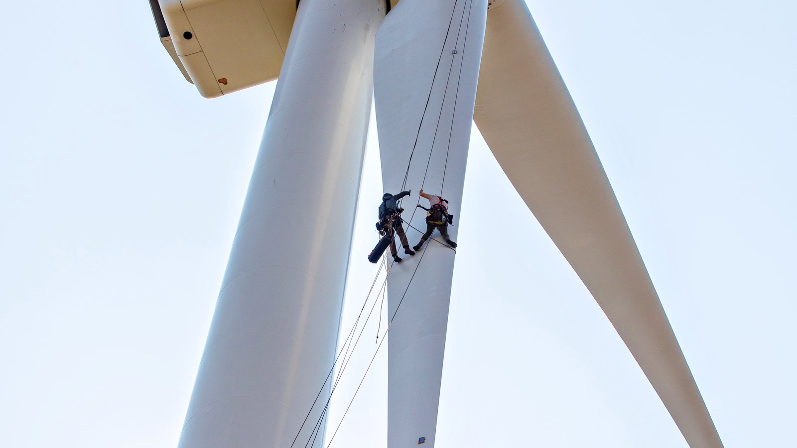
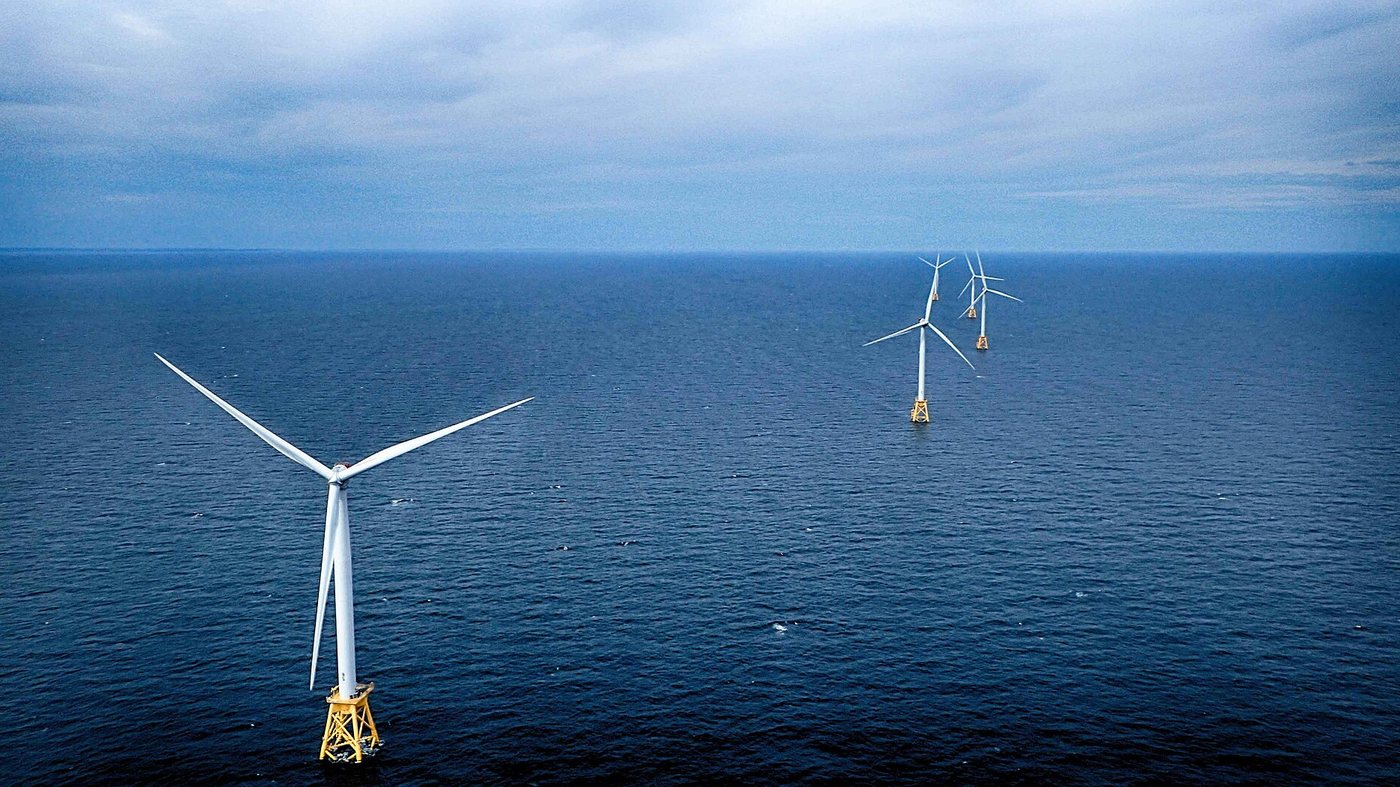
Block Island Wind Farm, Rhode Island, USA, the first offshore wind farm in the United States. Photo: Ionna22, CC BY-SA 4.0, via Wikimedia Commons. Cover photo: rope access technicians checking a blade on a research turbine (onshore), U.S. Department of Energy and NREL, public domain (source).
Which method fits which job?
Method
Good for
Limits
Drone visual survey
Whole-blade imagery from root to tip, no person working at height, easy to repeat on the same blade
Surface only. Wind, spray, visibility and GNSS or compass trouble near steel structures limit when you can fly
Rope access
Close visual checks, tapping and contact tools, minor repair work
Slower, more people at height, tighter weather limits, longer time with the turbine stopped
Long lens from a vessel or the ground
A quick look before deciding what else to do
Low resolution, bad viewing angles, vessel motion
Drone with a thermal or other sensor
Research direction for finding subsurface problems
Early stage. See the Sandia drone report in the sources
The Global Wind Organisation (GWO) blade repair training standard covers inspection and basic repair of glass fibre reinforced blades, so it is a useful reference for what a rope access crew is trained to do. A drone survey does not replace that work. It helps you decide where the crew should look.
Launching from a boat
Offshore, the launch platform is part of the inspection plan, not an afterthought.
Deck and wind: deck motion, turbulence behind the superstructure and spray all make take-off and landing harder than on land. Decide who handles take-off and landing, and where the aircraft goes if it cannot land.
Positioning: a moving vessel is a poor fixed reference. Check how your aircraft sets its home point, and what return-to-home does when the deck has moved. Steel decks and nearby structures can disturb compass and GNSS.
Small boats and uncrewed surface vessels (USV): the same questions apply in a smaller package: stable launch, safe recovery, and a place to fly back to.
Permissions: you need the local aviation authority rules, the wind farm operator's permission, and the vessel master's agreement. Marine coordination with the site comes first.
Resolution: what can you actually see?
Pick the smallest defect you want to log first, then work back to distance and lens. The ground sample distance (GSD) is the size of one pixel on the blade:
GSD = pixel pitch x distance / focal length
Illustrative numbers, not a specific camera: a 4.4 micrometre pixel pitch, a 24 mm lens and a 10 m distance give about 1.8 mm per pixel. A hairline crack narrower than one pixel may only show up through staining or shadow, and a defect needs to cover several pixels before a reviewer can classify it with confidence. Shorter distance, a longer lens or a higher-resolution sensor give finer GSD, but each one also costs you something: risk near the blade, coverage per flight, or file size. Always open test images at 100 percent before you commit to a capture plan.
Weather windows
The usable window is set by the tightest of three limits: the aircraft, the vessel and the site rules.
Wind and gusts: check forecasts at hub height as well as at the deck, and stay inside your aircraft manufacturer's wind limit.
Sea state: often the vessel decides before the aircraft does.
Spray, rain and fog: they affect the lens, the aircraft's ingress rating and what you can see in the image.
Light: glare on glossy white blades can hide erosion. Soft overcast light and low raking light tend to show surface texture better. Look at test shots on the day.
Lightning and temperature: both stop work. Cold also shortens battery life.
Write the go and no-go limits down before the trip. Do not decide them on deck, and plan some spare days.
From photos to orthomosaic and defect log
Capture plan: shoot each blade as four sides (leading edge, trailing edge, pressure side, suction side), root to tip, with forward and side overlap. Use the same plan on every blade so inspections can be compared.
Naming and metadata: turbine ID, blade position, side, and time in the file name or sidecar. Position along the blade (distance from the root) is more useful than GPS, which is weak on a vertical surface.
Stitching: build an orthomosaic or per-side strips where overlap allows. Blades are narrow and curved, and plain white surfaces give photogrammetry few features to match, so check the result against the raw images.
Defect log: one row per finding, with ID, turbine, blade, side, distance from root, defect type (for example leading edge erosion, crack, delamination, lightning damage), size and how it was measured, severity on the owner's or manufacturer's scale, photo references, reviewer and date. Do not invent your own severity scale.
Comparison over time: the same position on the same side across visits tells you more than one photo.
Handover: report, image set and a defect table the client can import into their maintenance system.
Automation can help with sorting files, naming, drafting tables and checking for missing images. Whether something is a defect, and how severe it is, is a decision for a qualified person. I do not quote a single detection rate for any method. Sandia's probability of detection work tested inspection methods on blades with engineered defects and measured sensitivity and repeatability, which is a reminder that results depend on the method, the defect type, the inspector and the conditions.
Who writes this
I am a drone pilot and software builder. As a freelancer, I do blade inspection data work (capture planning, orthomosaics, defect logs) in Taiwan, and AI automation for inspection workflows for clients in Taiwan and Japan. I also build apps around this work: the Turbine Inspection Simulator, Drone Command Center and Wind Hub. If you have an inspection data or automation job, email fabien-starseed@agentmail.to.
Global Wind Organisation(GWO)のブレード補修トレーニング規格は、ガラス繊維強化ブレードの点検と基本的な補修を対象としており、ロープアクセスの作業者が何を訓練されているかを知る参考になります。ドローン調査はその作業の代わりにはなりません。作業者がどこを見るべきかを絞り込む助けになります。
Is a drone enough to inspect an offshore wind turbine blade?只用無人機就足以檢測離岸風機葉片嗎?ドローンだけで洋上風力のブレード点検は十分ですか?
A drone gives a repeatable visual record of the blade surface from root to tip. It does not see below the surface, and it does not replace close inspection or repair by trained rope access crews. Sandia's drone report treated thermography on a drone as an early-stage research direction, not a finished method.無人機能提供從葉根到葉尖、可重複比對的葉片表面影像紀錄,但看不到表面下的問題,也不能取代受過訓練的繩索作業人員進行近距離檢查與修補。Sandia 的無人機報告把無人機搭載熱像視為早期研究方向,而不是成熟的方法。ドローンは付け根から先端まで、ブレード表面の再現性ある目視記録を提供します。内部は見えず、訓練を受けたロープアクセス作業者による近接点検や補修の代わりにもなりません。Sandiaのドローン報告は、ドローン搭載のサーモグラフィを完成した手法ではなく、初期段階の研究課題として扱っています。
What image resolution do I need for blade inspection?葉片檢測需要多高的影像解析度?ブレード点検にはどれくらいの画像解像度が必要ですか?
Start from the smallest defect you want to log, then work back to distance and lens. Ground sample distance is pixel pitch times distance divided by focal length. A defect should cover several pixels before a reviewer can classify it, so check test images at 100 percent before you fix the capture plan.先決定要記錄的最小缺陷,再回推距離與鏡頭。地面取樣距離等於像素尺寸乘以距離再除以焦距。缺陷通常需要涵蓋數個像素,審查人員才有把握分類,所以在定案拍攝計畫前,請先把測試影像放大到 100% 檢查。まず記録したい最小の欠陥を決め、そこから距離とレンズを逆算します。地上サンプル距離は、画素ピッチ x 距離 / 焦点距離です。欠陥は数ピクセルにまたがって初めて分類できるため、撮影計画を確定する前にテスト画像を100%表示で確認してください。
Can a drone be launched from a boat offshore?離岸時可以從船上起飛無人機嗎?洋上で船からドローンを発進できますか?
It can be done when the vessel, sea state, site rules and aircraft limits all allow it. Plan take-off and landing on a moving deck, check how the home point and return-to-home behave, and get the aviation authority, wind farm and vessel master permissions first.當船、海況、風場規定與飛機限制都允許時可以進行。請事先規劃在移動甲板上的起降,確認返航點與自動返航的行為,並先取得民航主管機關、風場業主與船長的許可。船、海況、サイトの規則、機体の制限がすべて許す場合は可能です。動く甲板での離着陸を計画し、ホームポイントと自動帰還の挙動を確認し、航空当局、風力発電所、船長の許可を先に得てください。
Can AI find blade defects automatically?AI 能自動找出葉片缺陷嗎?AIでブレードの欠陥を自動検出できますか?
Software can help sort files, name images, draft defect tables and flag missing photos. I do not claim a detection rate for any method, because results depend on the method, defect type, inspector and conditions. A qualified person should review every finding.軟體可以協助整理檔案、命名影像、草擬缺陷表,並提示缺少的照片。我不會為任何方法宣稱偵測率,因為結果取決於方法、缺陷類型、檢測人員與條件。每一項發現都應由合格人員審查。ソフトウェアは、ファイルの整理、画像の命名、欠陥表の下書き、写真の欠落の指摘に役立ちます。結果は手法、欠陥の種類、点検者、条件によって変わるため、どの方法についても検出率は示しません。すべての発見は資格のある人が確認すべきです。
Do you do blade inspection data work in Taiwan?你在台灣承接葉片檢測資料工作嗎?台湾でブレード点検のデータ業務を請け負っていますか?
Yes. I am a drone pilot and software builder. As a freelancer, I do blade inspection data work (capture planning, orthomosaics, defect logs) in Taiwan, and AI automation for clients in Taiwan and Japan. Email fabien-starseed@agentmail.to.是的。我是無人機飛手與軟體開發者,以自由工作者的身分在台灣承接葉片檢測資料工作(拍攝規劃、正射影像、缺陷紀錄),並為台灣與日本的客戶提供 AI 自動化。請來信 fabien-starseed@agentmail.to。はい。私はドローンパイロットでありソフトウェア開発者です。フリーランスとして、台湾でブレード点検のデータ業務(撮影計画、オルソモザイク、欠陥ログ)を行い、台湾と日本のクライアント向けにAI自動化を行っています。fabien-starseed@agentmail.to までメールをお送りください。
FREE · 60 MIN · NO PITCH免費 · 60 分鐘 · 不推銷無料 · 60分 · 売り込みなし
Book your free 1-hour call預約你的免費 1 小時諮詢無料1時間相談を予約する
Tell me a little about you and I'll email you back to lock in a time, usually within a day.留下你的資訊,我會回信與你敲定時間,通常一天內回覆。あなたのことを少し教えてください。日時を確定するためにメールでご返信します。通常1日以内です。
Thanks, your request is on its way to Fabien. You'll get an email shortly to confirm a time.謝謝,你的預約已送出給 Fabien。你很快會收到確認時間的電子郵件。ありがとうございます。リクエストはFabienへ送られました。まもなく日時確認のメールが届きます。